
Quick Navigation
30 Fascinating Geographical Facts About India You Should Know
India is often described through its diversity: different languages, cuisines, festivals, traditions and cultures.
But much of that diversity begins somewhere more fundamental: Geography.
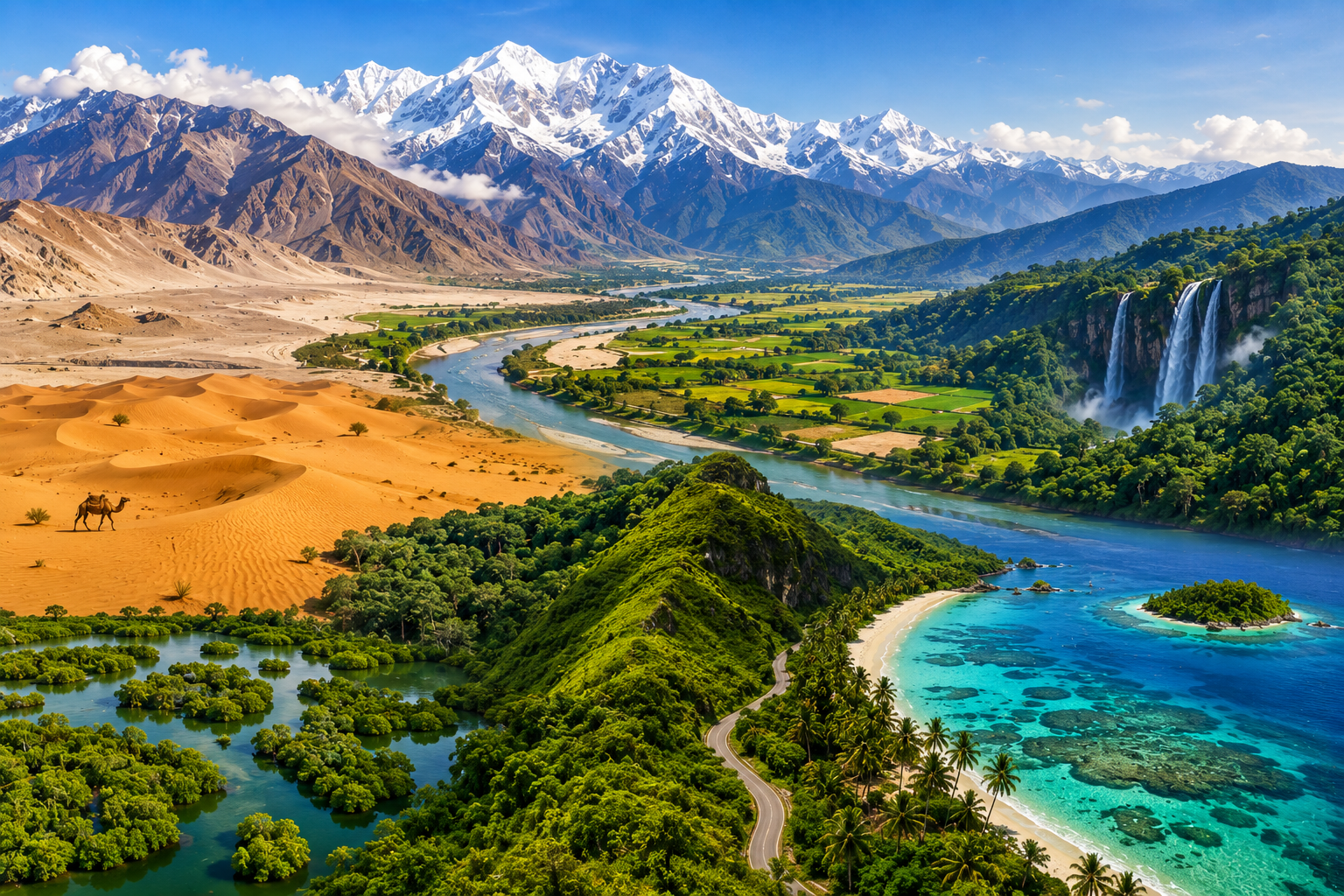
Within the boundaries of one country, the landscape changes dramatically. The mountains of the Himalayas give way to the plains of the Ganga and Brahmaputra, the arid landscapes of the Thar Desert contrast with the rainforests of the Northeast, while the country’s long coastline opens into the Arabian Sea, the Bay of Bengal and the Indian Ocean.
There are coral islands, mangrove forests, high-altitude deserts, enormous river systems, plateaus, fertile plains and some of the wettest places on Earth.
India’s geography is not merely a collection of physical features. It has influenced where communities settled, what crops they cultivated, how they travelled and, over centuries, how regional cultures evolved.
Here are 30 geographical facts about India that reveal just how varied the country really is.
1. India Has One of the Most Diverse Landscapes in the World
India’s physical geography can broadly be understood through several major regions: the Himalayan mountain system, the northern plains, the desert region and the Peninsular Plateau.
Within these broad regions are an extraordinary variety of landscapes, including valleys, forests, wetlands, plateaus, islands, coastal plains and deserts. The National Portal of India identifies the great mountain zone, the plains of the Ganga and Indus, the desert region and the southern peninsula as the country’s principal physical divisions.
That geographical variety is one of the foundations of India’s remarkable ecological and cultural diversity.
2. The Himalayas Form India’s Great Northern Mountain Wall
The Himalayas stretch across India’s northern landscape and form one of the world’s most significant mountain systems.
The Indian Himalayan region includes some of the highest mountains on Earth, as well as glaciers, deep valleys, high-altitude lakes and important river sources.
The mountain system extends for roughly 2,400 kilometres, according to the National Portal of India, with considerable variation in its width.
For India, the Himalayas are far more than a dramatic backdrop. They influence climate, water systems, ecosystems and human settlement.
3. India’s Northern Plains Were Shaped by Great Rivers
South of the Himalayas lie the vast plains associated with the Indus, Ganga and Brahmaputra river systems.
These plains are largely made up of alluvial deposits carried and deposited by rivers over enormous periods of time.
The result is one of the world’s great stretches of relatively flat and fertile land. The National Portal describes the plains as approximately 2,400 kilometres long and notes their exceptionally high population density.
Many of India’s major cities, agricultural regions and historic settlements developed within or around this broad geographical zone.
4. The Ganga and Brahmaputra Help Create an Extraordinary Delta Landscape
As major rivers approach the Bay of Bengal, their waters and sediments contribute to one of the world’s great delta systems.
The Ganga-Brahmaputra delta extends across India and Bangladesh and includes the extraordinary mangrove landscape of the Sundarbans.
Here, land and water are in constant conversation. Rivers divide and rejoin, tidal channels cut through forests, and islands and mudflats shape the landscape.
It is one of the clearest examples of how a river can influence an entire ecosystem.
5. The Sundarbans Are a World of Mangroves and Tidal Water
The Sundarbans occupy the deltaic region of the Ganga, Brahmaputra and Meghna river systems and are famous for their extensive mangrove forests.
The landscape is markedly different from the forests of central or southern India.
Instead of a conventional forest floor, there are tidal waterways, muddy banks, creeks and islands. Mangrove vegetation has adapted to this challenging environment, while the region supports a remarkable range of wildlife.
The Sundarbans demonstrate how profoundly geography can shape an ecosystem.
6. The Thar Desert Lies in India’s Northwest
The Thar Desert, also called the Great Indian Desert, occupies a large part of Rajasthan and extends towards the India-Pakistan border.
Yet the desert is not simply an endless expanse of empty sand.
It contains dunes, rocky terrain, seasonal water bodies, vegetation, villages and long-established human settlements.
The National Portal of India describes India’s desert region in terms of the Great Desert and Little Desert, with the broader landscape extending around the Rann of Kutch and the Luni river system.
7. India’s Geography Includes Both Hot and Cold Deserts
When people hear the word “desert”, Rajasthan usually comes to mind.
But India also has cold desert landscapes, particularly in the high-altitude regions of Ladakh.
Here, extremely low temperatures, sparse vegetation and high elevation create a landscape completely different from the Thar.
It is a useful reminder that a desert is defined by aridity, not simply by heat.
8. The Western Ghats Are Older Than the Himalayas
The Western Ghats run roughly parallel to India’s western coast, forming a dramatic escarpment between the Deccan Plateau and the Arabian Sea.
Geologically, they are far older than the relatively young Himalayan mountain system.
The Western Ghats are also recognised globally for their exceptional biodiversity and endemism.
Their forests, elevation and influence on rainfall make them one of India’s most important ecological regions.
9. The Western Ghats Influence the Indian Monsoon
Mountains do not merely occupy landscapes. They can alter the movement of air and rainfall.
The Western Ghats intercept moisture-laden winds associated with the southwest monsoon, contributing to substantial rainfall along the western side of the range.
This helps explain why parts of India’s western coast can be exceptionally wet while areas on the eastern or northeastern side of the Ghats may receive considerably less rainfall.
Geography, climate and agriculture are therefore closely connected.
10. The Northeast Has Some of India’s Wettest Landscapes
Northeastern India contains some of the country’s most remarkable rainfall patterns.
Mawsynram in Meghalaya is widely recognised as one of the wettest places on Earth.
The region’s geography is important to understanding this extraordinary rainfall. Moisture-laden air from the Bay of Bengal interacts with the hills and valleys of the region, producing intense precipitation.
The result is a landscape of waterfalls, forests, caves and extraordinarily green hills.
11. India Has a Volcanic Island
India’s geography includes a remarkable volcanic feature in the Andaman Sea.
Barren Island, part of the Andaman and Nicobar Islands, is known for its active volcano.
It is generally recognised as India’s only confirmed active volcano.
The island is uninhabited and its volcanic landscape provides a striking contrast to the tropical environment of the surrounding Andaman region.
12. Lakshadweep Is Made Up of Coral Islands
The geography of Lakshadweep is completely different from that of the Indian mainland.
Lakshadweep consists of a group of small islands in the Arabian Sea, many of which are associated with coral atolls and reefs.
The National Portal of India describes Lakshadweep as India’s coral-atoll island group and notes its distinctive lagoon and marine environment.
Its geography is therefore inseparable from the surrounding ocean.
13. India Has Island Territories in Two Different Seas
India’s island geography extends in two very different directions.
The Andaman and Nicobar Islands lie in the Bay of Bengal region, while Lakshadweep lies in the Arabian Sea.
The two island groups differ significantly in geology, landscape, ecology and culture.
Together, they give India a geographical reach that extends well beyond the mainland.
14. India’s Peninsula Extends Into the Indian Ocean
Look at a map of India and one feature immediately stands out: the southern part of the country projects into the Indian Ocean.
The Indian peninsula is flanked by the Arabian Sea to the west and the Bay of Bengal to the east, with the Indian Ocean to the south.
This position has had enormous consequences throughout history.
India’s coastline connected its communities with maritime trade routes linking South Asia with East Africa, Arabia and Southeast Asia.
15. India Has a Coastline of More Than 7,500 Kilometres
India’s coastline stretches for thousands of kilometres and includes mainland shores as well as island territories.
The coastline is anything but uniform.
There are sandy beaches, rocky shores, estuaries, mangrove systems, deltas, lagoons, coral reefs and fishing settlements.
That variety also means that coastal India does not have a single “coastal culture”. Food, architecture, occupations and traditions change considerably from one region to another.
16. The Deccan Plateau Covers a Large Part of Peninsular India
Much of southern and central India lies across the Deccan Plateau, a vast elevated region with a complex geological history.
Its landscape includes basaltic formations, rocky plateaus, valleys, forests and agricultural regions.
The plateau is one of the defining geographical features of peninsular India and has played an important role in the historical development of the Deccan.
17. The Eastern and Western Ghats Are Not Identical
India’s two major coastal mountain systems have very different characteristics.
The Western Ghats form a relatively continuous range along much of the western side of the Deccan Plateau.
The Eastern Ghats, by contrast, are more discontinuous and are intersected by several major rivers.
The National Portal of India notes that the Western Ghats generally have greater elevations than the Eastern Ghats.
Their differences are another example of how varied India’s physical geography can be within a single peninsula.
18. The Nilgiri Hills Connect the Eastern and Western Ghats
In southern India, the Nilgiri Hills form an important geographical transition between the Eastern and Western Ghats.
The National Portal identifies the Nilgiris as the southern point of the Peninsular Plateau where the Eastern and Western Ghats meet.
The region is also known for its distinctive highland climate, tea plantations, forests and hill stations.
19. India Has Both Glaciers and Coral Reefs
It is difficult to think of two more different environments.
Yet both occur within India’s geographical boundaries.
The Himalayan region contains high-altitude glaciers, snowfields and frozen landscapes, while Lakshadweep contains coral reefs and atolls in tropical seas.
This extraordinary range is one reason India is such an interesting country to study geographically.
20. The Country Has Several Major River Systems
India’s rivers are not simply individual waterways. They form interconnected geographical systems.
Among the most important are the Ganga, Brahmaputra and Indus systems, along with major peninsular rivers such as the Godavari, Krishna, Narmada and Mahanadi.
The northern rivers are strongly influenced by Himalayan snow and glaciers as well as rainfall, while many peninsular rivers have different seasonal patterns.
These rivers have shaped agriculture, settlements, transport, religious traditions and regional economies.
21. The Narmada and Tapi Flow Westward
Most major peninsular rivers flow broadly towards the east and eventually reach the Bay of Bengal.
The Narmada and Tapi, however, are notable exceptions.
Both flow westward towards the Arabian Sea.
Their courses are closely associated with geological structures in peninsular India and help explain some of the distinctive landscapes of central and western India.
22. India Has One of the World’s Great Biodiversity Landscapes
India’s geographical diversity creates a remarkable range of habitats.
Within the country are alpine environments, tropical forests, mangroves, grasslands, deserts, wetlands, coral reefs and coastal ecosystems.
This range supports an extraordinary variety of plants and animals.
India’s biodiversity is therefore not separate from its geography. It is, to a large extent, a consequence of it.
23. The Rann of Kutch Is a Landscape That Changes With the Seasons
The Rann of Kutch in Gujarat is famous for its vast white salt landscape.
But the landscape is not static.
Much of the region is seasonally inundated, and its appearance changes considerably through the year.
During the dry season, the exposed salt-covered terrain creates the spectacular white landscape for which the region is famous.
It is one of India’s most visually unusual geographical environments.
24. India’s Landscape Changes Dramatically With Elevation
Travel across India and you can move from tropical coastal environments to cool mountain landscapes within relatively short geographical distances.
Elevation influences temperature, vegetation, agriculture and settlement.
This is particularly visible in the Himalayas, Western Ghats and other hill regions, where altitude can create distinct ecological zones over relatively short horizontal distances.
25. India’s Geography Has Shaped Its Agriculture
The country’s agricultural diversity is closely tied to geography.
Rice thrives in regions with suitable rainfall and water availability. Wheat is particularly important across the northern plains. Tea is strongly associated with highland regions such as Assam and the Western Ghats, while spices, coconut and tropical crops flourish in warmer southern and coastal environments.
So when you look at an Indian food map, you are also looking at a map of climate, soil, elevation and water.
26. India’s Monsoon Creates Dramatic Geographical Contrasts
The Indian monsoon is one of the defining features of the country’s climate.
Its arrival and retreat influence agriculture, reservoirs, rivers, forests and everyday life.
But the monsoon does not affect every part of India equally.
One region may receive extraordinary rainfall while another remains comparatively dry. Mountain ranges, distance from the sea, elevation and wind patterns all influence these differences.
India’s geography and monsoon are therefore inseparable.
27. The Himalayan Rivers and Peninsular Rivers Behave Differently
One useful way to understand Indian geography is to compare its northern and peninsular rivers.
Many Himalayan rivers are fed by both rainfall and melting snow and ice, allowing significant flow beyond the monsoon season.
Many peninsular rivers are more strongly influenced by seasonal rainfall.
These differences have important consequences for agriculture, water availability and settlement.
28. India Has Landscapes Shaped by Ancient Geological Processes
Some of India’s landscapes are extraordinarily old.
The Peninsular Plateau contains ancient rocks and geological formations that predate the formation of the Himalayas by immense spans of geological time.
The Himalayas themselves are comparatively young in geological terms and continue to be shaped by tectonic activity.
In other words, India’s landscape is not a single geological story. It is a meeting point of very different chapters of Earth’s history.
29. India’s Geography Helps Explain Its Cultural Diversity
Geography does not determine culture, but it certainly influences it.
Coastal communities developed strong maritime traditions and cuisines shaped by seafood and tropical crops.
Mountain communities adapted to different climates and terrain.
River plains supported dense agricultural settlements.
Desert communities developed distinctive approaches to water, architecture, clothing and food.
Across India, geography has interacted with history, migration and human creativity to produce an extraordinary range of regional cultures.
That is why travelling across India can sometimes feel like moving between different countries without ever crossing an international border.
30. India’s Greatest Geographical Feature May Be Its Diversity
Perhaps the most interesting fact about Indian geography is not the height of a mountain or the length of a river.
It is the sheer range contained within one geographical space.
India has high mountains and low plains, deserts and rainforests, coral islands and volcanic islands, mangroves and alpine ecosystems, vast river systems and an enormous coastline.
The National Portal of India itself divides the country’s physical geography into major mountain, plain, desert and peninsular regions, but the real richness lies in everything that happens within and between those categories.
Geography has given India its physical diversity.
Over thousands of years, people have made that landscape their own.
And perhaps that is the most fascinating fact of all.
Frequently Asked Questions About Indian Geography
What are some interesting geographical facts about India?
India contains an extraordinary range of geographical features, including the Himalayas, the Thar Desert, the Ganga-Brahmaputra plains, the Deccan Plateau, the Western Ghats, extensive coastlines, coral islands, mangrove forests and volcanic landscapes.
What are the main geographical features of India?
India’s major physical divisions include the Himalayan mountain region, the northern river plains, the desert region and the Peninsular Plateau.
How many types of landscapes are found in India?
India contains many different landscapes, including mountains, plains, plateaus, deserts, forests, wetlands, islands, mangroves, coral reefs and coastal environments.
Does India have a desert?
Yes. The Thar Desert, or Great Indian Desert, occupies much of western Rajasthan and extends towards the India-Pakistan border.
India also has cold desert landscapes in high-altitude regions such as Ladakh.
Does India have volcanoes?
Yes. Barren Island in the Andaman and Nicobar Islands is known for its active volcano and is generally recognised as India’s only confirmed active volcano.
Which are the major mountain ranges in India?
The Himalayas are India’s most prominent mountain system. Other important ranges and highland systems include the Western Ghats, Eastern Ghats, Aravalli Range, Vindhya Range and Satpura Range.
What are India’s major river systems?
The Ganga, Brahmaputra and Indus are among the major northern river systems. Peninsular India also has important rivers including the Godavari, Krishna, Narmada, Tapi and Mahanadi.
Does India have coral islands?
Yes. Lakshadweep is India’s coral-atoll island group in the Arabian Sea.
Why is India’s geography so diverse?
India covers a vast geographical area and contains major differences in elevation, climate, geology, rainfall and proximity to the sea. These factors have produced a remarkable variety of physical environments.
Final Thought
A map of India can look deceptively simple.
Look closer and it becomes a story of mountains pushing upwards, rivers changing course, seas shaping coastlines, forests adapting to rainfall and people building lives around the landscapes they inhabit.
India’s geography is not merely about where places are. It helps explain why they became what they are.
And that is what makes exploring India so endlessly rewarding.